Starting point: locality Piredda in the Golgo Plateau, Baunei
Description:From Baunei take the road which leads to the plateau of Golgo (turn right after St Nicholas church in Baunei and follow the directions to San Pietro (St Peter)- Golgo.
After a few hairpin turns on a steep slope, you reach the Supramonte, and after a stretch of downhill road (about 8 km) you find the little church but before reaching it, please notice a sign on the right for Cala Sisine, leave the paved road and follow that direction.
After about 1,5 kilometers, in close proximity to Nuraghe Orgoduri turn right following the directions to Ispuligidenie (wooden sign) and keep going for a few hundred meters on an uneven road until the arrival to a small shepherd shelter with a clearing on the right. Leave the car and start walking in the North direction (with a 4×4 it is possible to continue to the next clearing). After a 15-minute walk, you arrive at locality Piredda, a wide dirt clearing: on the left you can notice Bacu Mudaloru with its access to the sea; while if you look NE you will see the ridge of Serra Lattone, your destination.
Take the narrow footpath on the right and proceed for about 5 minutes then leave the path and take a new one on the right ( on the left you can notice a big holm oak while a white stone indicates the turn, we are about 410 m above the sea level). Here you can see a structure which acts as a rainwater harvesting system and drinking trough for animals, keep walking in direction NE climbing on the hillside. The path becomes steeper and steeper, pay attention to some red signs indicating Bacu Boladina turn (Selvaggio Blu’s route) and at this point turn left and keep on climbing on the slope till you reach some old abandoned shelters, they are the Cuiles de S’arcu e su Tasaru.
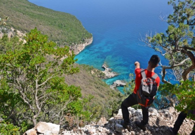
Go past the shelters walking between the first and the second hut to the North (530 a.s.l) and walk on a slight slope to reach the height of 560mt on the side of Serra Lattone (maximum height 588mt). The trail is always visible and marked, thanks to some volunteers who made the passage more accessible. After a few hundred meters the path begins to descend. At this point the landscape shows some spectacular glimpse of Orosei’s Gulf.
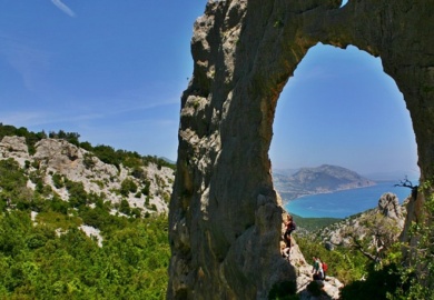
You can see the first “Scalone” (rustic wooden ladder) in juniper wood, after which there is a stony ground and it is noticeable an impressive rock arch carved in the mountain; at its left there is a small wooden door and right beyond a second “scalone” that allows to overcome a height difference of 10mt.
Heading downwards you cross the third leap with the usual aid of the juniper ladder. At this point it is recommended to proceed with extreme caution due to the presence of several small leaps easy to cross thanks to the recent protective railings posed on the trickiest points. In a short time you enter the thick oak forest following the ancient winding route among the trees which was created by the charcoal burners many years ago.
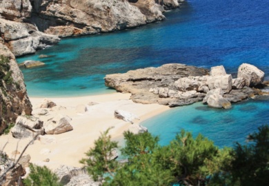
By this time you should be able to spot the blue of the sea among the leaves. You are standing in front of a road-fork: on your right the path turns to Spiaggia dei Gabbiani(Seagull Cove), but following the clear track on your left you can easily reach a small clearing with an old furnace built by the charcoal burners over a century ago.
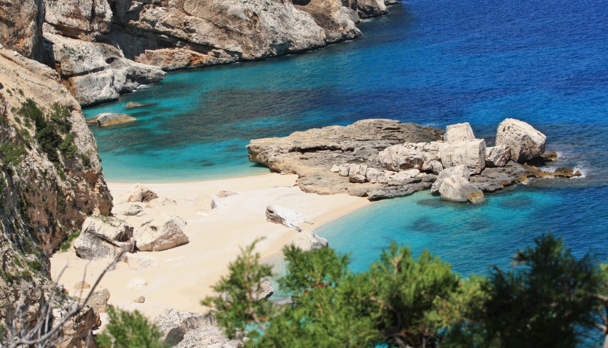
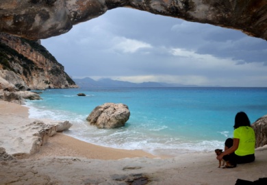
Finally a last ladder allows you to overcome the last obstacle on the cliffs to reach the wonderful beach composed of tiny white pebbles… as tiny as fleas and as white as snow: Ispuligidenie!