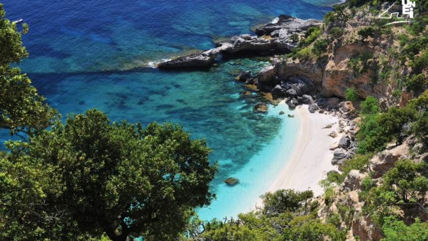
Forrola and Punta Giràdili
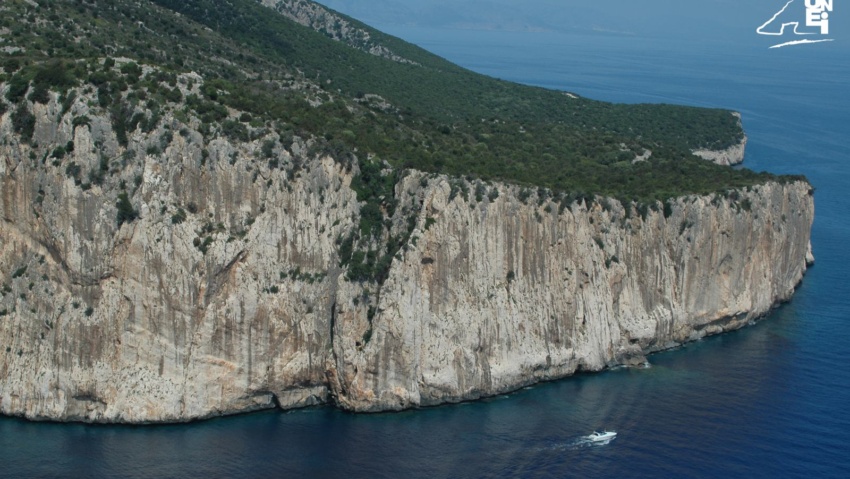
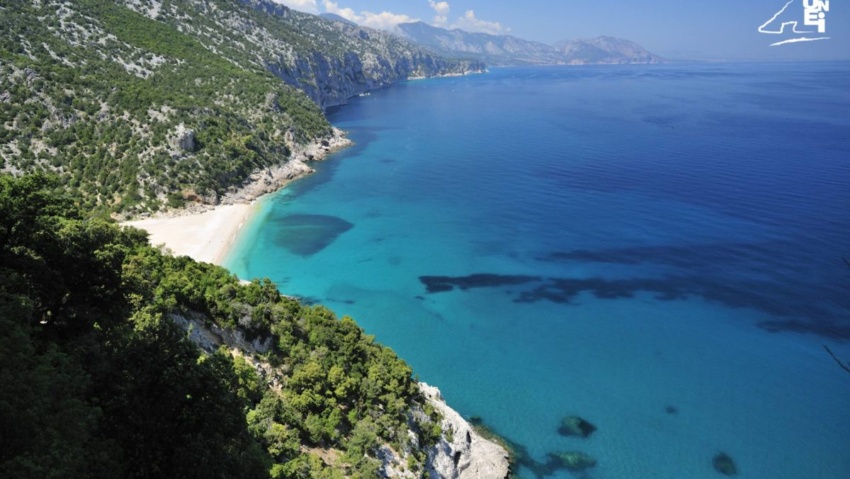
To the north of Pedra Longa is “Forrola” bay, dominated by the majestic “Punta Giradili”, which, at 765 metres, is one of the highest cliffs in the Mediterranean. Forrola bay is home to a pebble beach of the same name, reachable by land along the initial section of the path which begins the first stage of the “Selvaggio Blu” (“Wild Blue”) trek. The track branches off from one of the last bends of the paved road leading to the square of Pedra Longa and it takes about half an hour to get to the beach. The seafloors at Fòrrola are particularly appreciated by underwater fishing enthusiasts and scuba divers.
In the past, the entire area behind the beach (up to the limestone cliffs of “Loppòdine”, which border Fòrrola to the north), as was the case at “Golgo” and “Margine”, was used to cultivate grain by the “bidassone” method. Even now, hidden among the vegetation, local guides are able to identify the barnyards used by farmers for threshing during the harvest. On the first leg of the “Selvaggio Blu” trek, there is a path that climbs towards the head of the valley, making use of what is left of a mule track made by coalmen and passing at the foot of the steep rock face of Punta Giràdili. The trail leads to a fold named “de Us Piggius”, which offers a panoramic view across the bay of Fòrrola. Inland, not far from Giradili, is the peak of Mount Ginnirco (811 metres in height), whose name is a deformation of “Genna ’e Ircu” (“Gate of the Billy Goat”, from the Latin “hircus”, meaning billy goat).
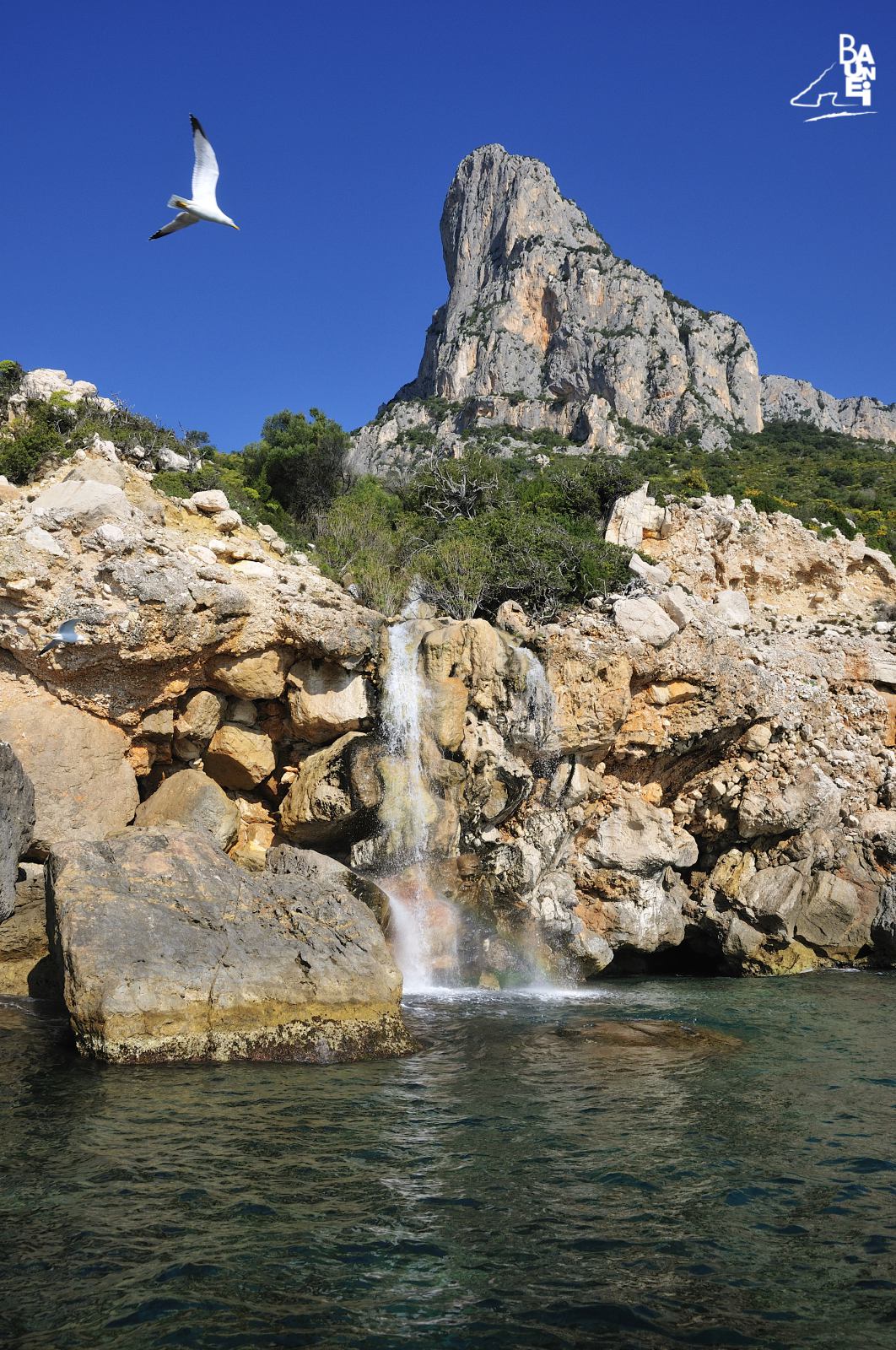
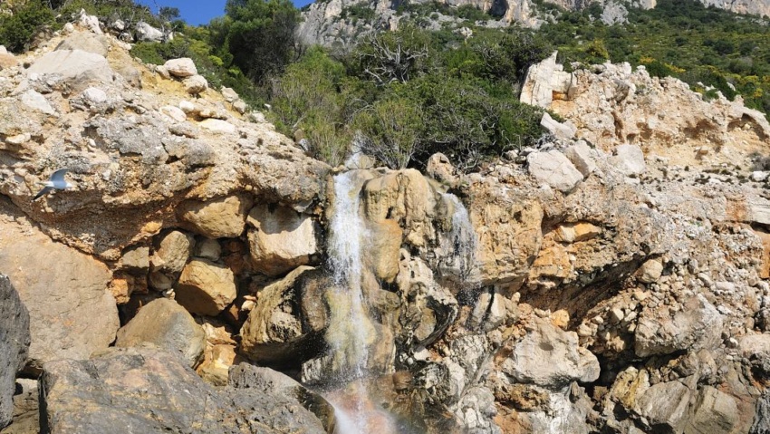
On the slope that begins at the base of Punta Giradili, the numerous oleanders reveal the presence of a stream: it is the “Baus” spring, which flows into the sea via a small waterfall, a few dozen metres north of Fòrrola beach. In particularly rainy years, the waterfall manages a substantial flow of water even in summer. A detail that at the time of the barbarian invasions did not escape the pirates. In this regard, there is a significant episode in 1806 (reported in certain documents kept in the State Archives in Cagliari) which proves that the pirates knew the Sardinian coastline very well. In June of that year, a fleet of 40 vessels (and a total of over one thousand men) engaged in looting along the eastern coast of Sardinia, stopped leisurely at the “Bàus” spring to replenish their water supply.
RELATED POST
The promontory of Capo Monte Santu marks the southern border of the Gulf of Orosei, whose northern border is at Capo Comino.
To the north of Pedra Longa is “Forrola” bay, dominated by the majestic “Punta Giradili”, which, at 765 metres, is one of the highest cliffs in the Mediterranean.
Sailing northwards, about a mile away from the ‘Mudaloru’ beach, is the ‘Grotta del Fico’ (Fig Cave), which opens up in the limestone cliffs, about 10 metres above sea level.
Cala Sisine is, without doubt, along with the more famous Cala Luna, one of the most interesting beaches on the coast of Baunei.

‘Cala dei Gabbiani’ (Seagull Cove): this beach, about 250 metres long, owes its name to the fact that dozens of seagulls gather here every evening around sunset.
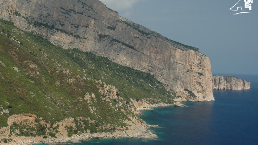
The roughness of navigation along the cliffs of Capo Monte Santu has been known since antiquity, and many historians identify this stretch of the east coast with the ‘Insani Montes’ mentioned by numerous authors, especially in connection with tragic shipwrecks.
Along the coastline, a few miles north of Santa Maria, is the limestone peak of “Pedra Longa”.

Inland from Cala Sisine, about an hour’s walk from the beach, it is a very evocative cave, whose very name reveals some curious characteristics: it is called the “Grotta del Miracolo” (“Su Meraculu”, in Sardinian).
Cala Goloritzé, Baunei Coast: spectacular beach framed by limestone, crystal clear sea and mountains. A popular destination for excursions and climbing.

Divided into two parts by a large rock used as a docking pier by the barges carrying tourists, it is now known by the double name of ‘Ispuligidenie – Cala Mariolu’.
The beach of “Cala Birìala” (called “Birìola” by the Cala Gonone fishermen) was one of the beaches most often visited by monk seals.
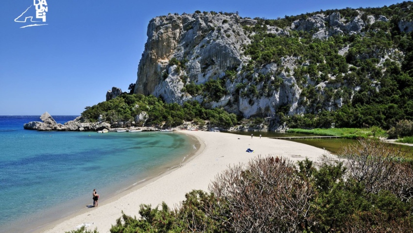
A beach, that of Cala Luna, which already at first glance shows that it fully deserves the definition of ‘Pearl of the Mediterranean’.