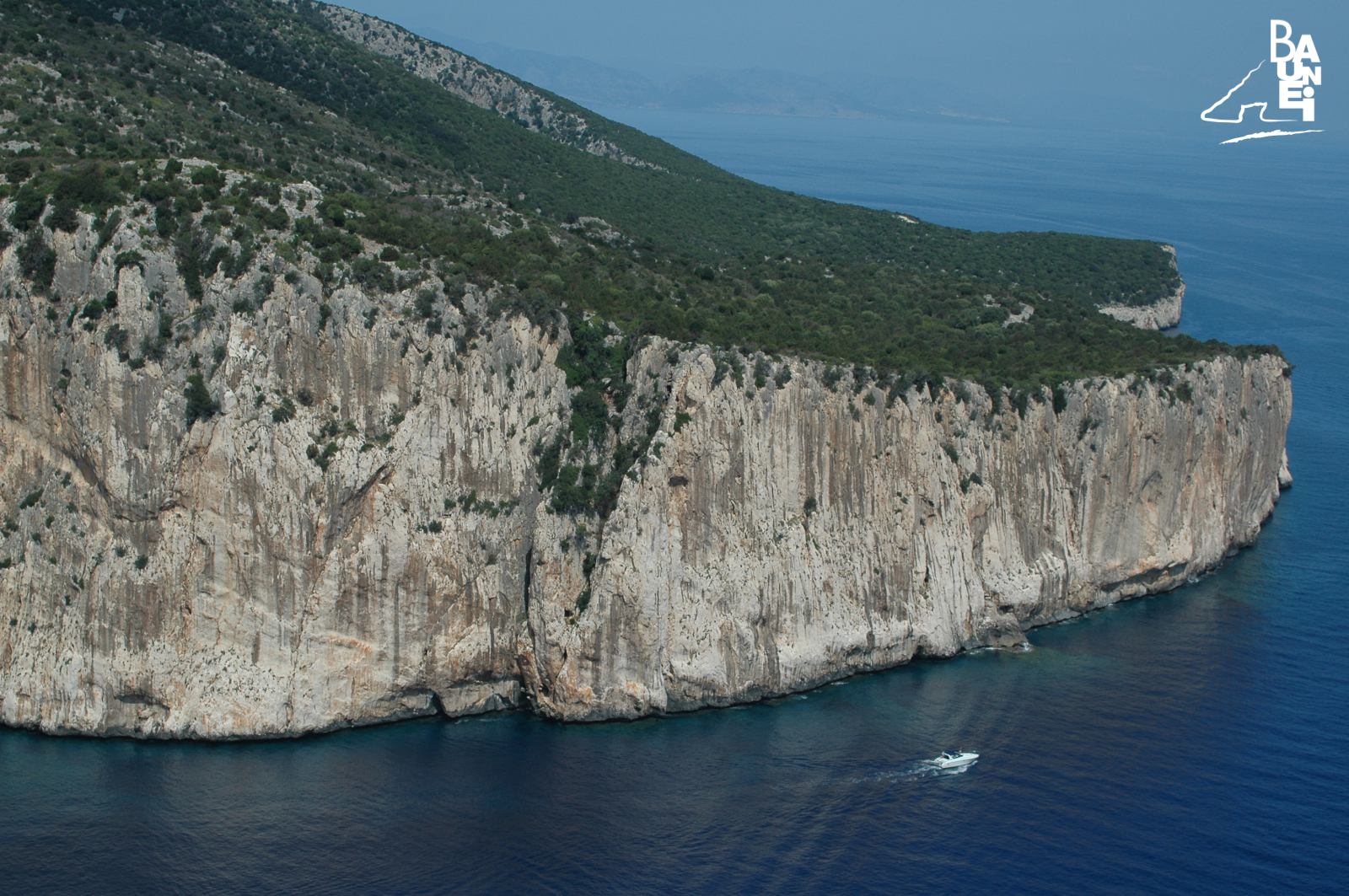
Capo Monte Santu cliffs
The promontory of Capo Monte Santu marks the southern border of the Gulf of Orosei, whose northern border is at Capo Comino. “This cape, which is well known to sailors, – noted La Marmora, struck by the majesty of the cliffs, in his work “Itinerary of the island of Sardinia” – has a sheer drop at a considerable height above sea-level, which washes the its cliffs, several hundred metres in height; in calm weather they can be touched by hand, because they plunge vertically into the sea down to a great depth”.
The stretch of coastline at Capo Monte Santu is particularly rugged, with some coves that penetrate tens of metres into the limestone walls as if they were fjords. These indentations of the coast, only visible to those who sail very close to the cliffs, are called “Portu” in Sardinian, because in certain weather conditions they allow small boats to get close to the cliffs. Sailing northwards from the south, vessels come across, in order: “Portu Pedrosu”, “Portu Cuau” and “Portu Eltiera”. “Portu Pedrosu”, which literally means “stony port” (because it ends in a small beach made of stones and pebbles), is called “Portu Porru ’e campu” by Baunesis herdsmen. In these parts, “Portu Porru ’e campu” is the Sardinian name for a particular species of wild garlic, the “triquetrum garlic”, a herbaceous bulbous plant with white flowers streaked with green that grows mainly in moist and shady ground and evidently, in the past, was so widespread in the area behind the small fjord that it encouraged herdsmen to associate the name to the creek. La Marmora mentions this name in 1857: “It is located in a cove, called Porru ’e Campu, before you reach the Guglia [the peak of Cala Goloritzè]”. The final part of the cove is very narrow and can only be reached by small crafts. “Portu Cuau”, which means “hidden port”, is a wider cover than “Portu Pedrosu”, and, during the era of the coalmen, was a landing point for the vessels that loaded the coal produced in lay-bys behind. “Portu Cuau” also boasts two names; it is known among the fishermen of Arbatax and Cala Gonone as “Cala Tramontana”. “Portu Cuau”, which is larger and wider than “Portu Pedrosu”, can also accessible be accessed by medium size vessels. “Portu Eltiera”, which unlike the two “ports” that precede it does not extend lengthwise, is a recess in the sheer cliffs on the coastline that does not seem like a safe haven in the event of rough seas at all.
RELATED POST

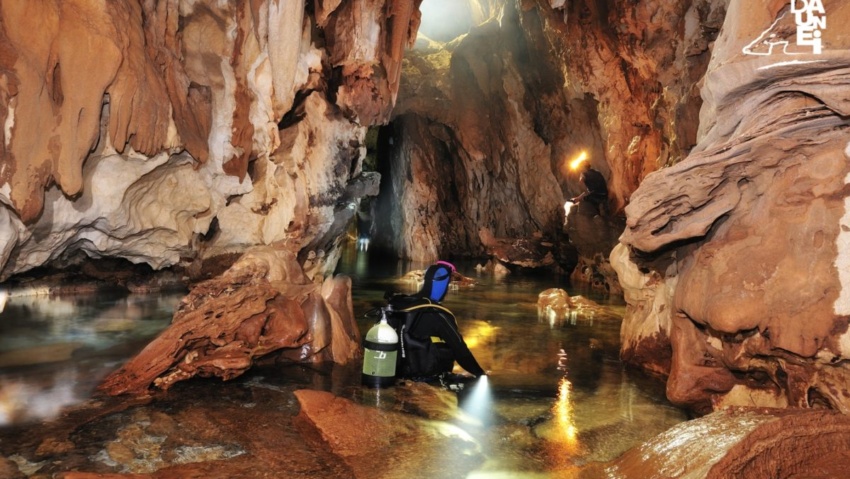
The “Grotta dei Colombi” is only accessible by sea and in order to see the stunning majesty of the vault up close, it is necessary to sail very close to the cliff.
Sailing northwards, about a mile away from the ‘Mudaloru’ beach, is the ‘Grotta del Fico’ (Fig Cave), which opens up in the limestone cliffs, about 10 metres above sea level.
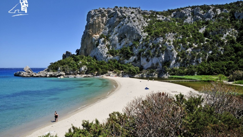
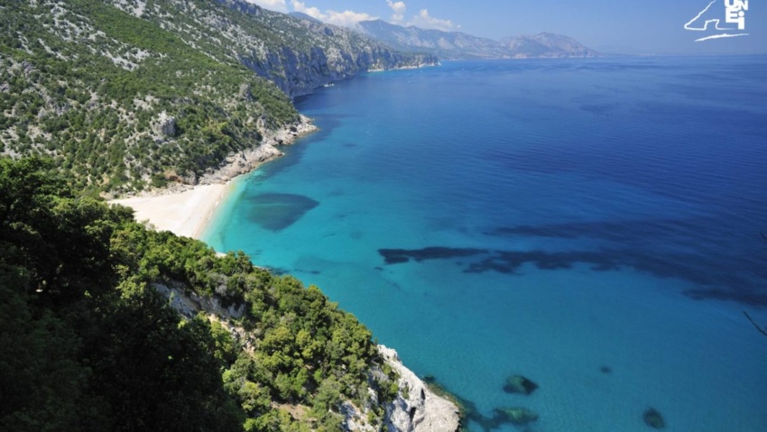
A beach, that of Cala Luna, which already at first glance shows that it fully deserves the definition of ‘Pearl of the Mediterranean’.
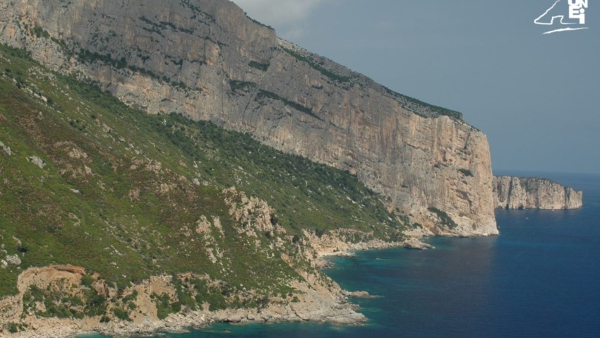
To the north of Pedra Longa is “Forrola” bay, dominated by the majestic “Punta Giradili”, which, at 765 metres, is one of the highest cliffs in the Mediterranean.

‘Cala dei Gabbiani’ (Seagull Cove): this beach, about 250 metres long, owes its name to the fact that dozens of seagulls gather here every evening around sunset.
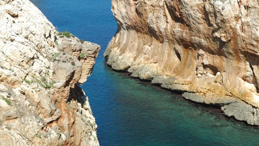
Portu Cuau – Baunei Coast
Along the coastline, a few miles north of Santa Maria, is the limestone peak of “Pedra Longa”.
The roughness of navigation along the cliffs of Capo Monte Santu has been known since antiquity, and many historians identify this stretch of the east coast with the ‘Insani Montes’ mentioned by numerous authors, especially in connection with tragic shipwrecks.
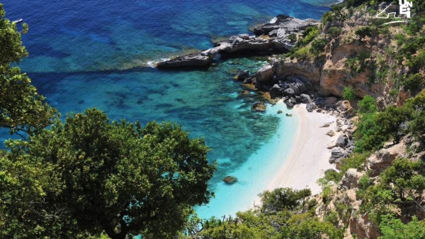
Cala Sisine is, without doubt, along with the more famous Cala Luna, one of the most interesting beaches on the coast of Baunei.
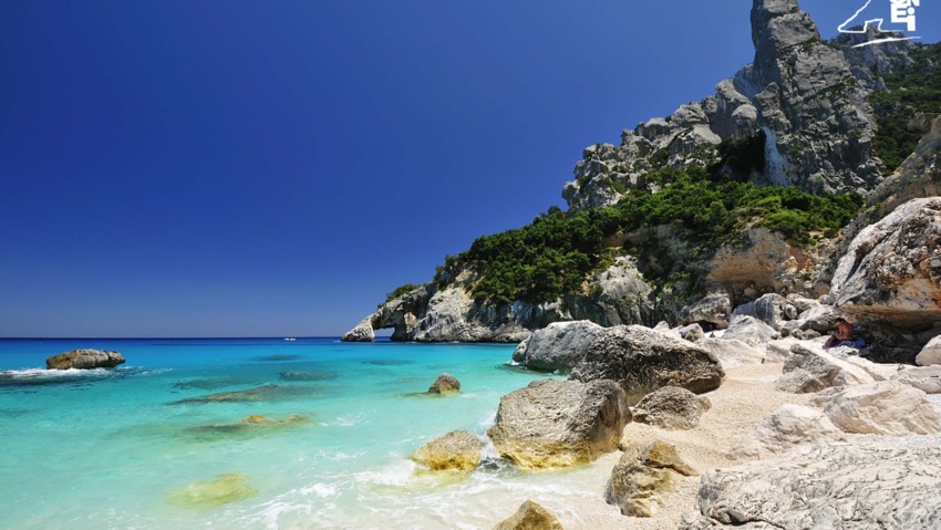
Cala Goloritzé, Baunei Coast: spectacular beach framed by limestone, crystal clear sea and mountains. A popular destination for excursions and climbing.

Inland from Cala Sisine, about an hour’s walk from the beach, it is a very evocative cave, whose very name reveals some curious characteristics: it is called the “Grotta del Miracolo” (“Su Meraculu”, in Sardinian).
The beach of “Cala Birìala” (called “Birìola” by the Cala Gonone fishermen) was one of the beaches most often visited by monk seals.