
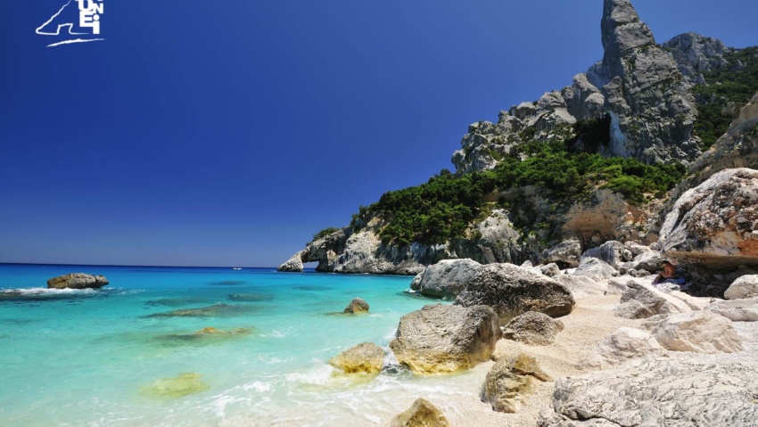
Cala Goloritzè path
Continuing along the dirt road alongside ‘As Piscinas’, you reach the locality called ‘Su Porteddu’, where begins the path that leads to Cala Goloritzè, one of the best known coves on the east coast of Sardinia. Cala Goloritzè, famous for the rock arch that plunges into the sea just a few metres from the beach and for the slender peak, ‘Punta Caroddi’ (148 m. above sea level), is one of the four ‘Natural Monuments’ of the Baunese territory (the others are ‘Su Sterru’, the Olivastri di S. Maria Navarrese and ‘Pedra Longa’).
Reaching the small beach of Goloritzè starting from ‘Su Porteddu’ is a captivating experience. At the beginning of the route, one faces an uphill path (up to an altitude of 490 metres) that, however, after a few minutes’ walk, turns into a steep descent, which in an hour leads to a dreamlike beach, where the transparency of the water and the majesty of the limestone spires leave you breathless.The ascent to ‘Su Porteddu’ is not as pleasant as the descent, due to the considerable difference in altitude, but thanks to the refreshing shade provided by some majestic holm oaks at the steepest point of the route, even the return journey (about two hours) can become a pleasant and healthy walk.
All along the trail, traces are evident of the cart tracks built by the charcoal burners to transport coal to the sea, where it was loaded onto merchant ships. At one point on the path, the final part of the cart track can clearly be seen, which from ‘Bacu ‘e Linnalbu’ (in Sardinian ‘linnalbu’ = ‘ash tree’) enters the ‘Bacu Goloritzè’.
A toponym within the ‘Bacu Goloritzè’ indirectly reveals that at the time of the Saracen raids, this canyon was one of the incursion routes used by pirates to reach the hinterland. In fact, about half an hour’s walk from the beach, at a point that is easily accessible today thanks to the remains of the mule track made by charcoal burners, there was once one of those passageways equipped by shepherds with juniper branches (‘scalones’), called ‘Su scalone ‘e su turcu’. Literally, it means ‘the Turk’s ladder’, because according to tradition, a shepherd killed a Saracen (‘unu turcu’) on that spot.
Such toponyms, which recall tragic battles, are not uncommon along the east coast. In the territory of Dorgali, for example, there is a toponym, ‘S’elighe ‘e su turcu’, upstream from Cala Gonone, which recalls a majestic holm oak (‘elighe’), felled a few decades ago, to which a Saracen captured by Dorgali shepherds was tied.
How to book
CONTATTI
Via San Nicolò, 2 – 08040 BAUNEI (Sardinia, Italy)
infopoint@turismobaunei.eu
+39 349 5462583
RELATED POST
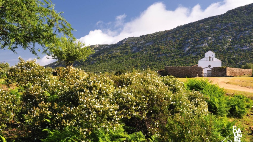
The country church dedicated to St. Peter, with that unmistakable, white angular facade that stands out against the backdrop of the mountains separating Golgo from the sea.
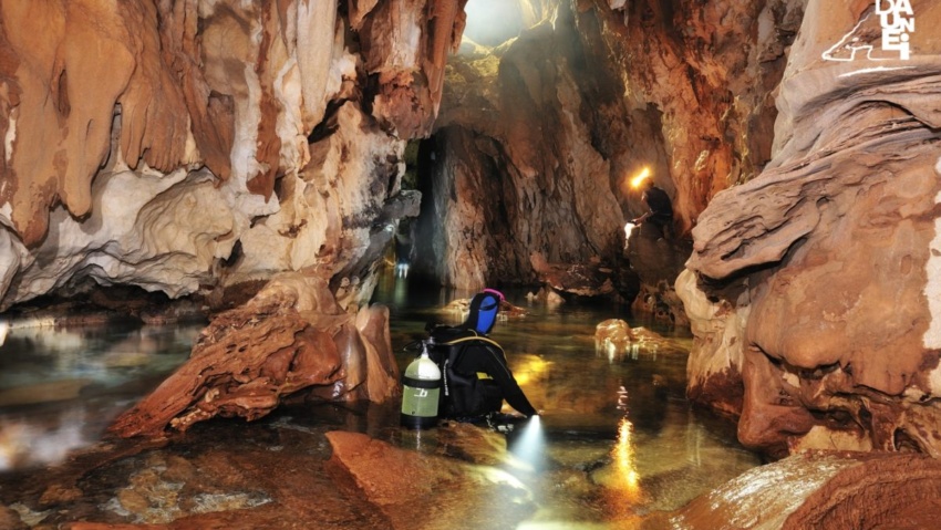
Sailing northwards, about a mile away from the ‘Mudaloru’ beach, is the ‘Grotta del Fico’ (Fig Cave), which opens up in the limestone cliffs, about 10 metres above sea level.
Continuing along the dirt road alongside ‘As Piscinas’, you reach the locality called ‘Su Porteddu’, where begins the path that leads to Cala Goloritzè.